
11 moshavim already use it
The land register and the map, in one place
A village GIS for managing land holdings in a moshav. The land register is linked to the plot layer, and every change to a plot shows up in the register at once.
You start from your existing Excel file. Nothing is typed in again.

The land register is in Excel. The map is somewhere else.
The table is updated by hand, each time by someone different. The plot layer isn't in sync with it. In the end, nobody is sure what the current state of a holding is.
What it costs the moshav
- Allocation errors
Gaps between what the table records and what is on the ground.
- Disputes between members
Without one agreed source, every change starts an argument.
- Office time
Hours spent cross-checking files and maps by hand, and producing reports.
- Readiness for the Israel Land Authority and others
Hard to present an orderly picture when it's needed.
Land management. One up-to-date picture.
SYLORA links the land register with the plot layer. Change a plot on the map and the table shows it at once, so everyone works from the same source.
The land register
What you keep in Excel today.
The plot layer
What you keep on the map today.
One up-to-date picture
What you get: the register and the map, linked.
Four steps from Excel to a live system
The moshav doesn't re-enter anything: you start from the register's existing Excel file.
- 1
Import
Load the land register's Excel file.
- 2
Link
Each record is linked to its plots on the map.
- 3
Edit
Update a member's plot right on the map.
- 4
Update
The change shows up in the table at once.
Built on one GIS for the whole village
Land management sits on the village's GIS, which is simple to run and lets you make your own edits.
- Infrastructure
- Zoning plans
- Surveys
- Plots
- Buildings
- And more
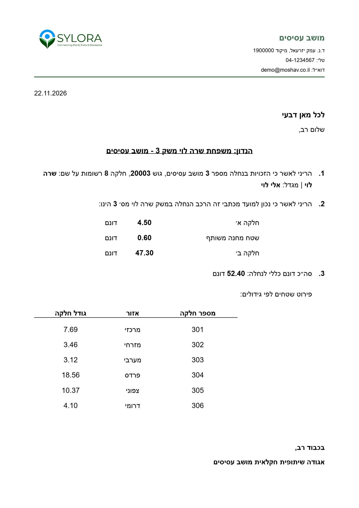
A holding report for every member
Residential and farm areas by the makeup of the holding, based on the current data in the system and exported in one click.
- The holding's makeup
The farm's plots, each with its area in dunams.
- Breakdown by area
Plot number, area and size, in one table.
- Sent to farm owners
Produce the reports and send them straight from the system.
11 moshavim already use the system
I work with the GIS every day, and it has become a central part of how we run things. Beyond everything the system can do, what really makes the difference is the people behind it: their expertise, their availability, and their willingness to listen, think together and adapt solutions to what comes up in the field.
Today all the information on our holdings is in one place, the register and the map both. When something changes, we update it once and everyone sees the current data. It brings a lot of order, saves time and makes the daily work much easier.
The system keeps growing with our needs. When we need a change or help, there's always someone to talk to and the answer comes fast. Working with a GIS makes the moshav's land management more efficient and more accurate.
Getting started
Estimated setup time: 4 weeks. No technical knowledge needed.
- 1
You send the data
The land register in Excel and the plot layer.
- 2
We set it up
We link the data in the system and check it.
- 3
You go live
A short training for the office, and you start working.